Aerial drone view of a resort style backyard with freeform pool futuristic. Images Created by www.Future-Home.Shop

Visualisation tool

See Your Top View Yard Design
Looks Before you build

A birds-eye view is how designers actually think: it shows proportion, circulation and how much usable space is left after the pool, the pergola and the beds are placed. Use the viewer below to switch yard type and viewpoint on any concept in the collection.

Interactive viewer

Choose a yard, choose a viewpoint

Modern Tropical Island Resort Pool Retreat Top / Drone View of a backyard landscape design concept. Images Created by www.Future-Home.Shop

Top / Drone View

Modern Tropical Island Resort Pool Retreat

View from Above "Satellite style" Birds-eye Plan of Whole Design

Four featured top view designs

Planning your home from the birds-eye view

Four of our best drone view designs — luxury, Tuscan, modern and tropical island homes — each showing how a birds-eye plan gives you the perspective, space and measurements to build the yard you actually want.

Part one

Why the top view is the most important stage of planning

The first thing a birds-eye view gives you is proportion. Seen from above, a pool, a timber deck and a lawn each read as a deliberate shape, and the gaps between them matter as much as the shapes themselves. From ground level you would never notice that balance; from a drone view it is the only thing you see. That is why designers begin here, long before choosing pavers or plants.

This is also why so many designers now sketch a rough top view before ever picking a paving colour or a plant palette: it forces the big decisions — how much of the yard is hard surface, how much is lawn, how much is garden bed — to be made deliberately rather than by accretion as the project develops.

A top view is also the honest test of whether your yard can hold everything you want in it. Measure the block, draw it to scale, then place the pool, the terrace and the lawn as blocks of area. If they do not fit on paper, no amount of clever detailing will make them fit on site. Freeform, resort style pools especially need to be set out from above, because a curve drawn at eye level usually ends up lumpy, too narrow to swim in, or awkward to pave around.

Drone photography has made this kind of checking far easier for an ordinary homeowner than it used to be. A single overhead photograph taken from a small consumer drone, printed and marked up with a scale ruler, does most of what a professional survey plan does for the purposes of laying out a pool, a deck and a lawn, and it costs almost nothing compared with the price of getting the proportions wrong in the ground.

The plan view is where you plot shade too. Palms, cabanas and pergolas throw shadows that travel across the yard through the day, so mapping them from above lets you put seating where it will be comfortable at 1pm rather than where it merely looked good on a sketch.

Materials read differently from directly above than they do at eye level, which matters for anyone using a top view to choose finishes. A pale stone terrace can look larger and more dominant in an aerial photograph than it feels standing on it, while a timber deck of the same size tends to recede and blend with surrounding planting — worth knowing before committing to a material based on a render alone.
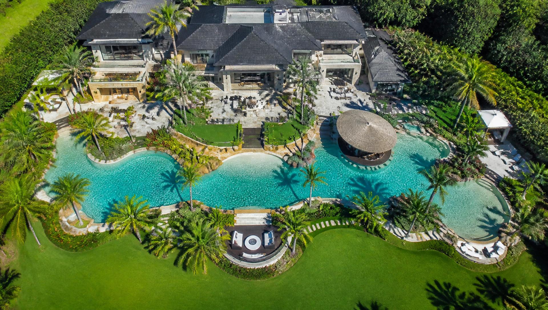
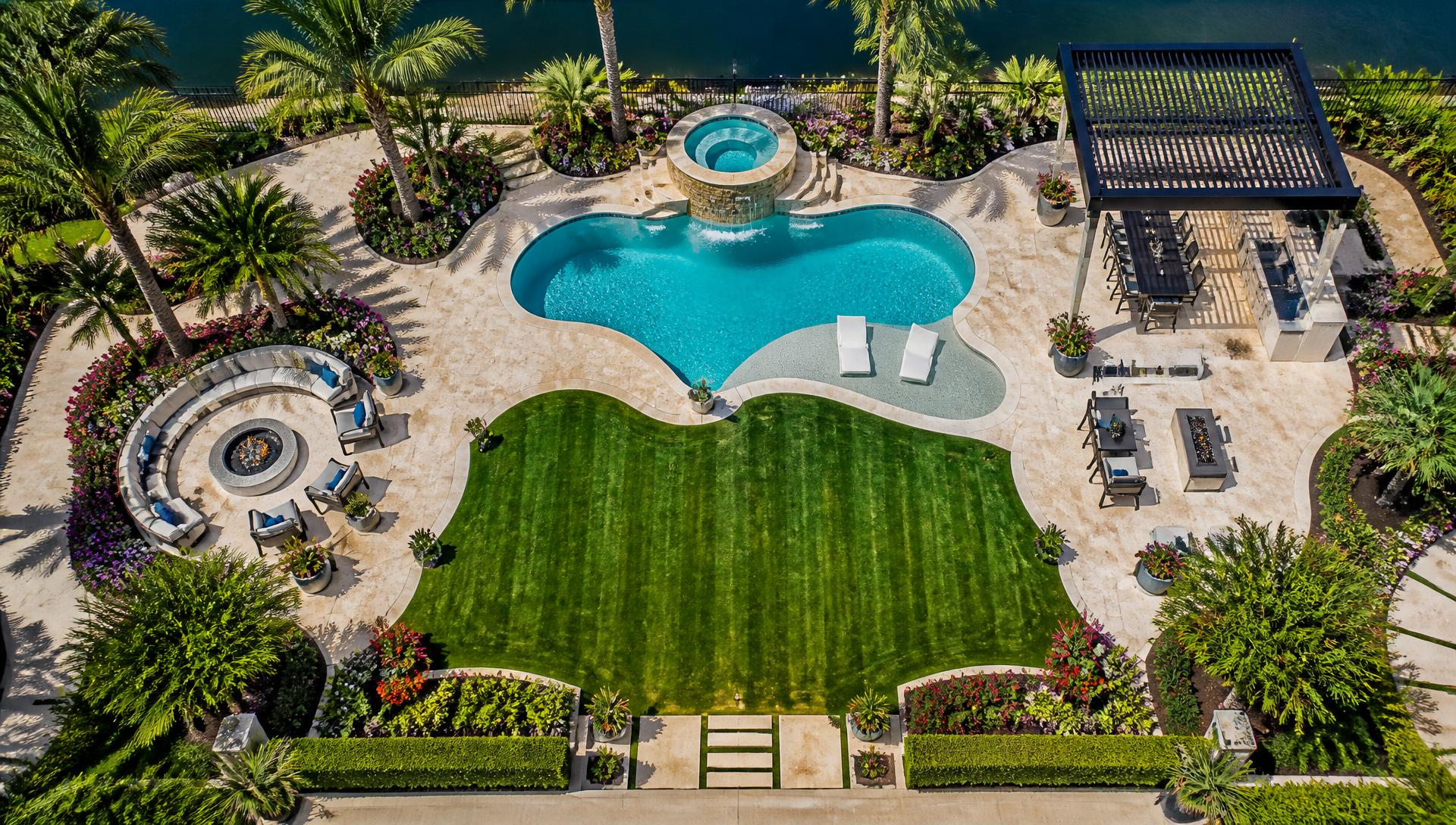
Aerial top view of luxury exotic estate with turquoise freeform pool cabanas and tropical palm gardens. Images Created by www.Future-Home.Shop
Luxury exotic estate: proportion read from above

Part two

Arrival, symmetry and the centre line that ties it together

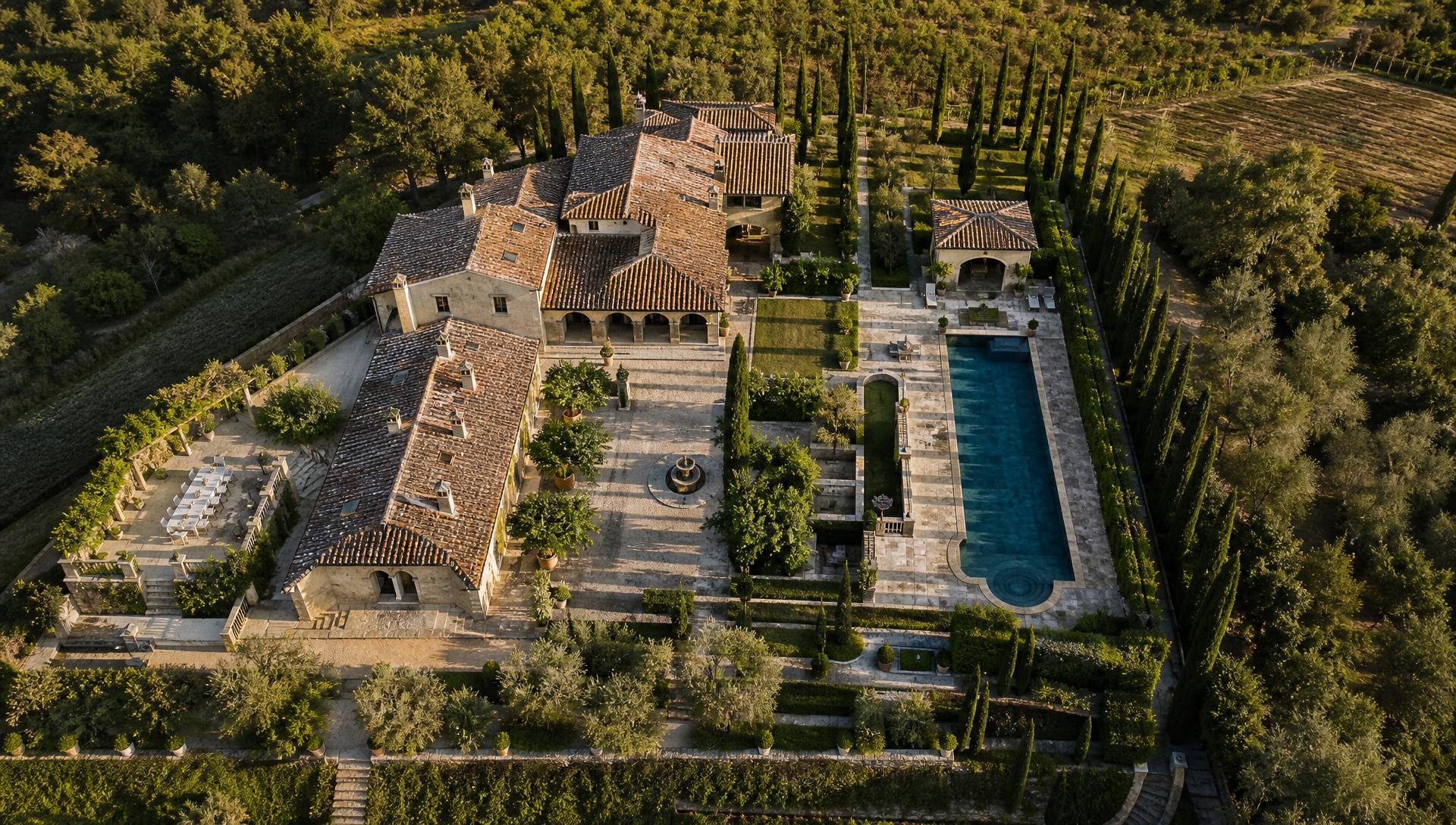
Older estate gardens teach the clearest lesson in plan view: everything lines up. A gravel courtyard, an olive terrace and a long rectangular pool all share one centre line drawn off the front door, and because that spine is set out from above, every path and step you add afterwards has something to measure from. Take the spine away and the same elements look scattered no matter how beautiful each one is.

This same discipline scales down perfectly to an ordinary suburban block. Even without formal terraces or an avenue of trees, drawing a single centre line from the back door through the main entertaining zone to the rear boundary gives an amateur designer the same organising benefit a professional gets from a full symmetrical plan — everything added afterwards has a line to measure from.

Levels are the other half of the story. On sloping ground each terrace is a flat platform cut into the hill, stairs are set out to a consistent rise, and retaining, drainage and safety clearances get resolved on the drawing rather than in concrete. Firepits need 3m of clearance from structures and overhanging branches, and pool fencing has non-negotiable setbacks that are far easier to accommodate on paper.

Getting levels right in plan also determines where water goes in heavy rain, which is not something a nice render ever shows. A top view marked with fall arrows and drainage points reveals whether stormwater will head towards a rain garden as intended or pool against a retaining wall, and it is far cheaper to correct a fall on paper than to re-excavate a finished terrace.

Aerial top view of Tuscan villa estate with cypress olive grove gravel courtyard and rectangular lap pool. Images Created by www.Future-Home.Shop
Tuscan style villa: arrival, symmetry and terraces

Part three

Space, measurements and the sites that seem impossible

Most homes are not estates, and this is where top view planning earns its keep. On a standard suburban block every square metre is contested: pool, lawn, clothesline, shed, dining terrace and side access all want the same ground. Only a plan view shows you honestly how much is left once each one is drawn at real size. Allow 3.5m for dining, 3m for a lounge setting and 1.2m of clear paving beside the pool, and the leftovers become obvious immediately.

This same top-view exercise is where a household should also mark out the ground needed for less glamorous but increasingly essential items: a battery and inverter enclosure with clear ventilation space, a wall-mounted EV charger with room to open a car door beside it, and a small hard-standing pad kept clear of overhanging branches for drone deliveries. None of these need much room, but each one needs to be drawn to scale rather than squeezed in as an afterthought once the paving is finished.

Courtyards and narrow blocks are the strongest argument for planning from above. With the garden wrapped by walls, a few hundred millimetres decides whether a path feels generous or pinched, and a birds-eye view reveals dead corners, doors that open into furniture and routes that force you to walk through the seating. Stack the zones down the length of a narrow yard — deck, pool, lawn, firepit — and each one gets its own moment instead of competing for the middle.

Narrow blocks are also where the top view earns its keep for services planning. A single conduit trench run the full length of a narrow yard, marked on the plan before excavation begins, can carry lighting, irrigation and a spare data or power line for a future automation panel, avoiding three separate trenching jobs dug at three different times over the life of the garden.

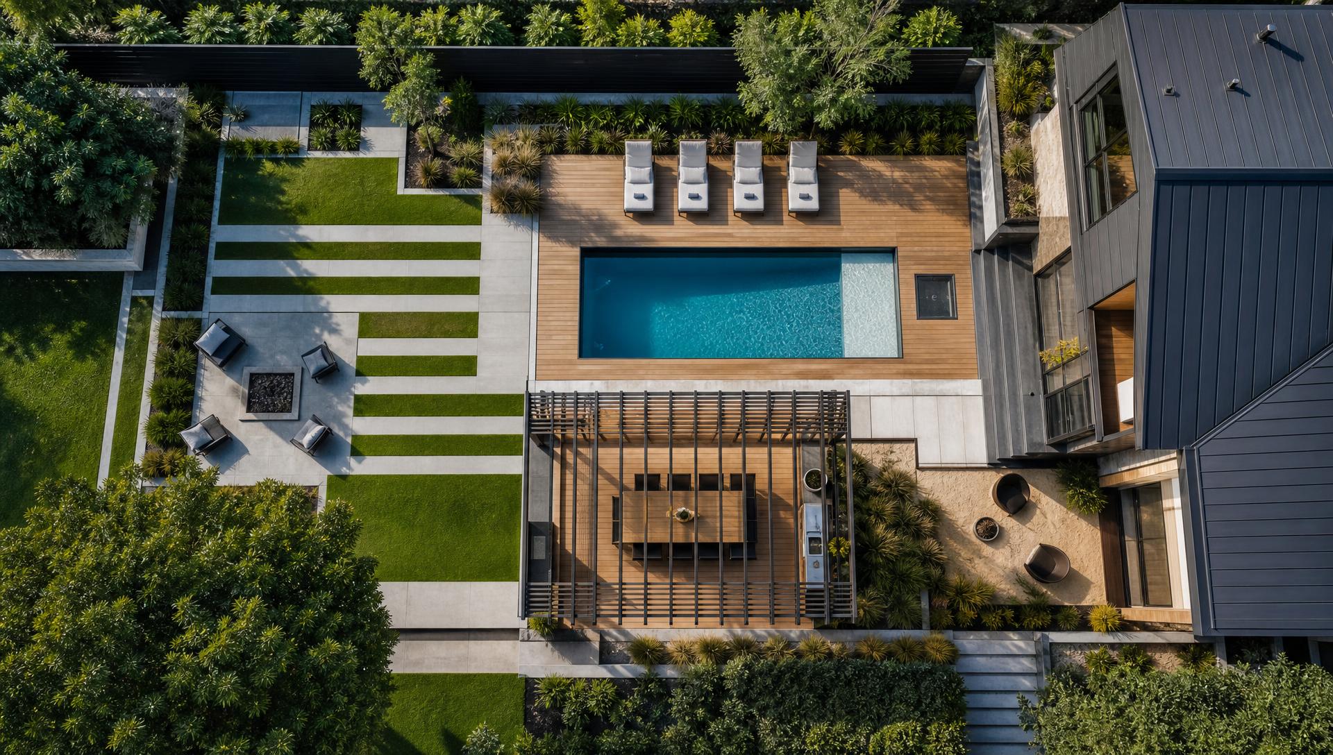
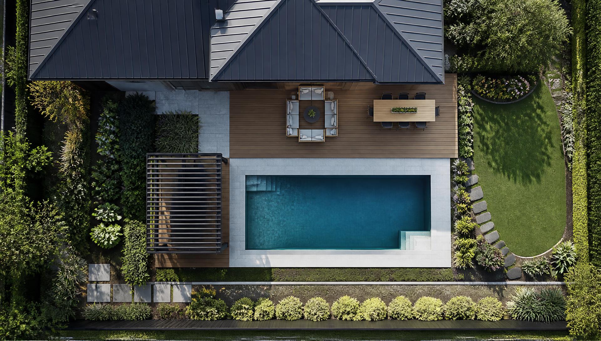
Aerial top view of modern architectural home with timber deck geometric pool dining pergola and lawn. Images Created by www.Future-Home.Shop
Modern home: zoning, clearances and circulation

Part four

From night presence to one plan, front to back

Lighting is the most commonly forgotten layer, and it is best designed from above. Marking uplights, path lights, pool lights and pergola fittings on the plan shows you the pattern of glow you will actually see at night, and exactly where the dark gaps will fall. Because most entertaining happens after dark, the night plan often justifies moving a whole zone: if the dining terrace sits in the one part of the yard with no lighting and no power run, better to discover that on paper than after the paving is laid.

Solar panel orientation belongs on this same aerial plan. Marking the roof planes that receive full sun through the middle of the day, and cross-referencing them against any trees that will eventually grow tall enough to shade them, prevents the common and expensive mistake of installing panels beneath a canopy that looked harmless at planting size but casts real shade a decade later.

The final and most useful drawing is the whole block in a single top view: street, driveway, house footprint, side access, pool, lawn and entertaining zones together. Print it, mark your measurements on it, and take it to every quote — one accurate birds-eye plan is the cheapest insurance you can buy.

Keep updating this master plan as the garden matures rather than treating it as a one-off exercise. A tree that was a metre tall at planting will eventually shade a solar panel or a vegetable bed that depended on full sun, and revisiting the top view every few years is the simplest way to catch that kind of drift before it becomes a real problem.

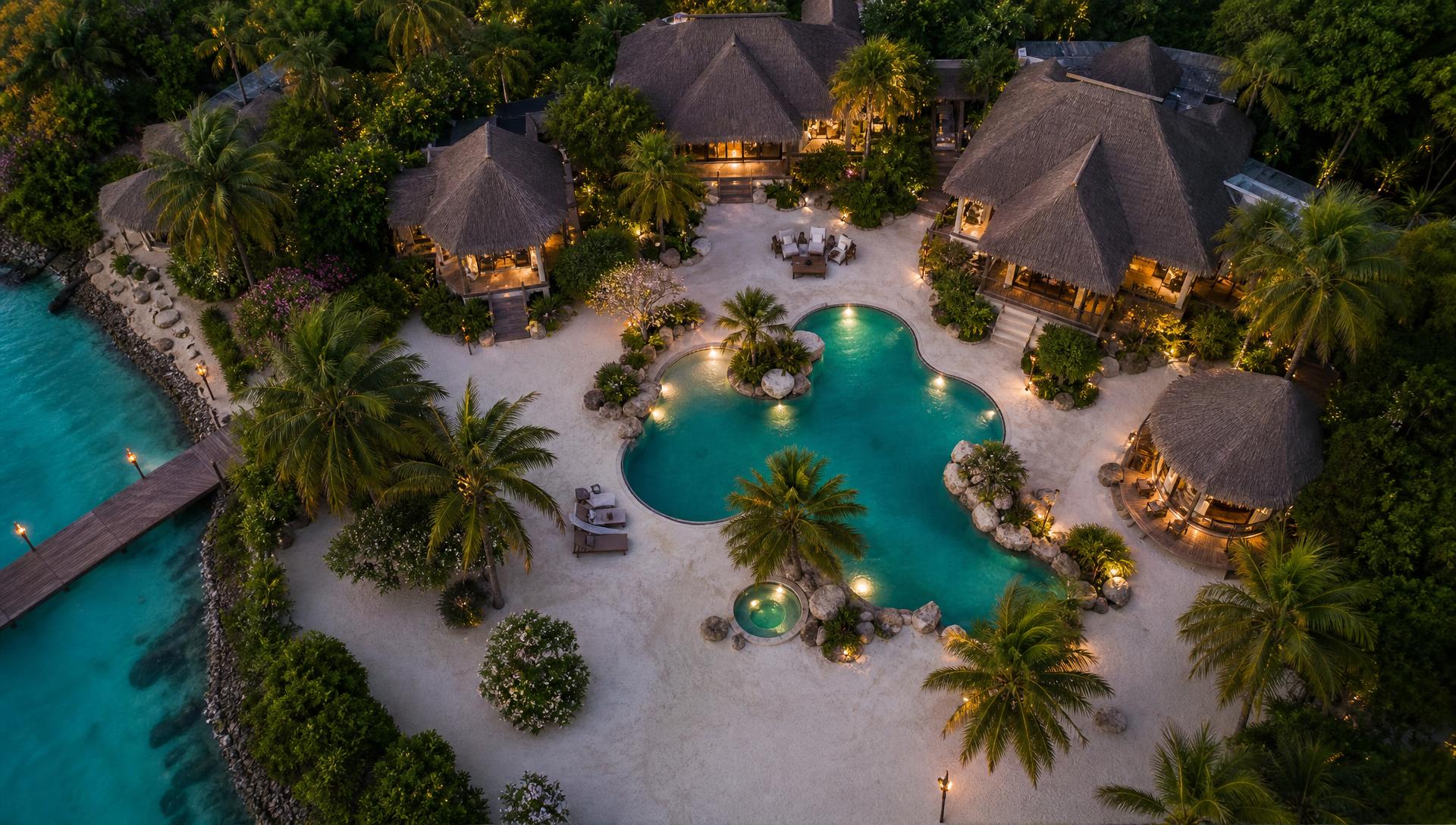
Aerial top view of tropical island luxury home with thatched pavilions lagoon pool palms and beach. Images Created by www.Future-Home.Shop
Tropical island home: the whole property in one plan

What to look for in the top view

  • Circulation: can you walk from the back door to the shed without crossing the lounge setting?
  • Proportion: paving and lawn should feel like deliberate shapes, not leftovers.
  • Bed depth: thin ribbon beds around a fence line always look mean from above.
  • Shade coverage: the shadow of a pergola at 1pm tells you if it is in the right place.

What the four alternate views tell you

The forward view is the one guests get when they step outside. The rear view is what you see from the kitchen window, which is the view you will actually live with. The left and right side views expose the parts of a yard that plans normally ignore — fence lines, screening, meter boxes and service access.

Turning views into a plan

Sketch your own boundary to scale on grid paper, drop in the fixed items (house, driveway, trees you are keeping), then place the zones you saw in the concepts. If a zone does not fit in plan, it will not fit in reality no matter how good the render looks.

Planning from above

Why the aerial plan is becoming the true starting point for home design

Every discipline that plans outdoor space — architecture, landscape design, even drone photography — starts the same way, by looking straight down. A top view strips away the theatre of render and reveals only what actually matters: proportion, circulation, shade and how much usable ground is left once every fixed element has been placed. As homes take on more infrastructure — solar arrays, battery enclosures, EV charging bays, drone landing pads — that discipline of planning from above only becomes more important, because none of these additions can be squeezed in as an afterthought once the paving is down.

The next fifty years of home design will very likely be drawn, quite literally, from the sky first and the eye level second. Drone photography and satellite-accurate site plans are already standard tools for architects and landscape designers, and as more of a home's systems live outdoors — charging points, service pads, delivery zones — the plan view becomes the only drawing that shows how all of it fits together honestly.

Setting out a site that has to do more than it used to

A generation ago, setting out a block from above meant placing a house, a driveway, a lawn and a garden bed. Today the same exercise has to accommodate a charging bay near the garage, a battery and inverter enclosure with clear ventilation and access, an irrigation manifold, and increasingly a small hard-standing pad for drone deliveries positioned away from pedestrian paths, pools and children's play areas. None of these additions is large, but each one needs to be set out to scale rather than squeezed in wherever space happens to remain.

This is why measuring and drawing to scale before committing to any material choice matters more now than it ever has. A charging cable run that looks trivial on a rough sketch can turn out to cross a garden bed, a driveway that looks wide enough for two cars can prove too narrow once a charger post and its clearance zone are added, and a landing pad drawn without checking overhead power lines or nearby trees is simply unusable. All of these problems are cheap to fix on paper and expensive to fix in concrete.

Circulation, proportion and reading a home from directly above

Good circulation, seen from above, looks like a clear route from the back door to the shed, the bins and the car without crossing a lounge setting or a garden bed. Poor circulation is invisible from eye level until the family has lived with it for a year and worn a diagonal path across the lawn. A top view exposes these desire lines before they are ever cut into turf.

Proportion works the same way. Paving, lawn and garden beds photographed from a drone either read as deliberate shapes with breathing room between them, or as leftover space with no organising idea behind it. The difference is almost always decided at the plan stage, long before a single paver is chosen, which is why the aerial view remains the most honest test of a design before it is built.

Shade mapping and the materials that read differently from above

Shade is one of the few elements that genuinely moves through the day, and a top view plan lets a designer track where a pergola, a mature tree or a neighbouring building will throw shadow at different hours. Mapping shade this way before committing to a dining terrace's position avoids the common mistake of a beautifully paved area that is unusable at the exact hour a family wants to eat outside.

Materials also perform differently from above than they do from the street. A pale stone terrace can visually dominate a small yard when photographed by drone, while a warm timber deck of the same footprint reads as calmer and better integrated with planting. Because most homes are now photographed from above for real estate listings and social sharing at some point in their life, choosing materials with that aerial view in mind is no longer a purely technical consideration — it affects how the finished home is perceived long after construction.

Lighting, energy systems and delivery access seen from the sky

Night lighting plans are best drawn in the same top view as everything else, because a lighting designer needs to see the pattern of glow across the whole block, not just individual fittings. Marking uplights, path lights and pergola lighting on the plan reveals dark gaps and overlaps that are impossible to judge by standing in the garden with a torch.

The same aerial logic now extends to a home's energy and delivery infrastructure. Solar panel orientation is calculated from an aerial view of the roof plane, battery and inverter placement is checked against ventilation and access clearances drawn from above, and EV charging bays are positioned relative to the switchboard and driveway width in plan rather than guessed at on site. Drone delivery landing pads and parcel drop hatches are simplest to place correctly when drawn on the same aerial plan as everything else — clear of overhead branches and wires, away from pedestrian paths, and close enough to the house for a short, secure walk to collect a parcel or a food order.

None of this replaces the pleasure of standing in a finished garden and simply enjoying it. It means that the drawing which makes that garden work — proportioned, shaded, lit and wired correctly — is now, more than ever, the one taken from directly above.